About Tour Package

Have you ever had this thought that you need to take a break from alpine hill treks and rather choose to do an expedition? Whether you’re a moderate or strenuous-level trekker, you definitely had this thought once in a while in your mind. So, it’s time to turn your thoughts or daydreaming into reality. Yes, if you are ready to push your trekking limits, then you must look forward to one of the most difficult Black Peak expedition.  

Black Peak, alternatively recognized as Kala Nag or Black Cobra in the local dialect, reigns as the loftiest and most emblematic summit within the Bandarpunch (Saraswati) range in the Garhwal Himalayas. Its towering elevation of 6,387 meters (20,955 feet) establishes it as a formidable challenge, demanding a mastery of advanced climbing techniques and extensive high-altitude trekking expertise. What distinguishes Black Peak is its distinctive formation that strikingly resembles the head of a cobra. Further intensifying its enigmatic appeal and securing its esteemed status among avid mountaineers pursuing an exhilarating and daring expedition. Black Peak, in fact, is not just a mountain; it’s a friendly behemoth wrapped in mystery and charm, waiting for adventurers and nature lovers to come and discover its secrets.   

The story of Black Peak begins with the efforts of British mountaineers in the early 20th century, and later, in 1979, the Indo-Tibetan Border Police team reached its summit. These achievements transformed it into a beloved destination for global adventurers, all drawn by its rugged charm and breathtaking panoramas.   

Region

Uttarakhand

Base camp

Sankri

Duration

15 Days

Grade

Difficult

Distance

98 km

Altitude

6,387 m

  • icon
    Tour Itinerary
    • Altitude: 1,950m/6,400ft (Sankri).
    • 220 km drive - approx 10 hours.
    • Pick up time 06.00 am from Prince Chowk, Dehradun.
    • Expected arrival time to Sankri – 5:00 pm.
    • Keep the original and copy of ID proof handy, have to show it at the forest check post of Sankri.
    • Available network BSNL (erratic).
    • Breakfast and lunch on the way (not included in the cost).
    • After Pulora keep a warm jacket handy.
    • Local Market is available.
    • Full functioning AMT at Pulora.
    • Sankri is the last road heading to the Govind Balabh Pant Wildlife Sanctuary.
    • Dinner at the guest house (included in the cost).
    • Stay in a Guest House (twin or triple sharing).
    Our journey starts from Dehradun where we will pick you up in Tata Sumo or similar vehicles at 6:30 AM. You are requested to report at the pickup point by the time. From Dehradun, we will drive to Sankri, which is at a distance of 220 km from Dehradun. It may take about 8 - 9 hrs or more to reach Sankri as the mountain roads can be quite bumpy at times. However, the road to Sankri is quite scenic. On your way, you will cross picturesque places like Mussoorie, Mori, Naitwar, etc. You will drive along the beautiful Yamuna and Tons Rivers with pine trees lining the road. The River is milky white in some places and clear green in others. The fragrance of pinewood and the beauty of nature will make up for the long ride to Sankri. The last stretch of the road, about 22 km from Sankri, is even more beautiful as you enter the Govind National Park, famous for being home to much exotic flora and fauna. On reaching Sankri, we will check in at our hotel. After freshening up, you can spend the evening at the quaint hamlet of Sankri at your leisure. You can head out for a stroll through this charming village. Sankri is a trekkers’ hub as it is the base camp for not one or two but 11 Himalayan treks including popular treks like Har Ki Dun. At Sankri BSNL network is available but it is very erratic. You can also watch a beautiful sunset at Sankri Village in the backdrop of the Himalayas, a great opportunity for shutterbugs to capture all the beauty around. At night, you can have dinner at your hotel or in the local village dhabas to get a taste of the local flavours. Stay overnight at Sankri and we will start our trek the following day.
    • Altitude: 2,600m/8,500ft (Seema) and 2,400 m/ 8,000 ft (Dhatmeer).
    • Sankri to Dhatmeer drive: 18 km | 1-1:30 hrs
    • Dhatmeer to Seema trek: 10 km | 6 - 7 hrs
    • Most of the trail is a gradual ascent.
    • Walk through the Supin River.
    • Trek is in the forest of Deodar trees, Bamboo, wild roses, irises and chestnuts.
    • Enough source of water on the way.
    • Osla village is opposite to Seema.
    • Packed lunch on the way.
    • Stay in a tent (Twin sharing).
    After breakfast, we will start early in the morning and drive to Dhatmeer from where the actual trekking begins. Dhatmeer is about a distance of 18 km from Sankri and we will reach there in approximately 1 to 1.5  hours. From Sankri you will drive through covers of Bamboo and Deodar trees and cross many streams along a zig-zag road to Sankri. There is also a camping ground near the Forest Rest house in Taluka and in some cases, people camp here as well. From Dhatmeer, our trekking starts and we will trek a distance of 10 km to reach our Seema campsite. Seema is on the right side of the Thamsa River and we will trek through a dense forest covered with Walnuts, Chestnuts, Willows, and other coniferous trees to reach Seema. The path along the River is stony. After a few hours of walking by the River and crossing some streams, you will arrive at Gangad Village and it will give you a glimpse of the typical Himalayan architecture. 20 minutes further walk and you will reach the water run mill and a Dhaba. After trekking for another hour, you will reach an opening to a construction site. The concrete construction is actually for a proposed school in the area. You will spot a wooden bridge that will take you to Osla. Osla Village has become quite a popular tourist destination due to its unique architecture and the presentation of Garhwali culture. Osla is home to about 200 families and you can observe the vibrant Himalayan lifestyle in the village. Seema campsite is only a tourist shelter point and it is not a village or settlement, Seema is just opposite Osla, on the other side of the River. Walking for about another hour, along the River you will reach Seema, where we will set up our camps and stay for the night. The path remains covered in snow and slush during winters.
    • Altitude: 3,100m/10,200ft.
    • Altitude difference: 500m/1,700ft.
    • Trek: 10km, 6-7 hours.
    • Moderate to difficult ascent and descent.
    • Can see the confluence of the Har Ki Dun and Ruinsara rivers.
    • Magnificent view of Black Peak (Kala Nag) from Debshu Bugyal.
    • Trek along with the Ruinsara River.
    • Mixed scenery of forest, meadows and boulders.
    • Enough source of water.
    • Packed lunch for the day.
    • Stay in a tent.
    Today we will trek along the Supin River to Devsu Bugyal and cross the Devsu Bugyal meadows, we will descend through a forest cover and a sandy and stony path down to the riverbed. Crossing the Supin River we will again trek along the river banks, the river now on our right to our campsite at Rain Basera. The path may also be a little slippery towards the end so be cautious. The trail begins with Supin River on the left and while ascending, the path soon becomes steep as you get closer to Devsu Bugyal, climbing up, you will get the views of Osla Village behind you and as you enter the Ruinsara Valley, the path becomes filled with boulders adding more challenge to your trek. 30 minutes further walk will bring you into Devsu Bugyal meadows and the meadow stretches for about 2 km. We will rest here for a while appreciating the natural beauty and witnessing the views of Kala Nag peak and Swargrohini in the backdrop. The Devsu Bugyal meadows are set amidst the Ruinsara forest and while ascending towards Devsu Bugyal, you will see a variety of Himalayan wildflowers and foliage. The forest is also home to many bird and animal species as well and hiking through the forest, you may even spot some rare species along the way. From Devsu Bugyal, there is an abrupt drop in the trail and you will have to descend all the way down to the riverbed. The path is filled with sand and stones and you will cross the bridge to get across the river this time, the River Supin will transfer to your right while it was on your left when you began the trek. Walking beside the river, you will now have to ascend once again. The trail has quite a steep ascent until Rain Basera, your next camping spot. After a steep climb, you will reach your campsite at Rainbasera. The Rain Basera campsite is very peaceful and it also has one small hut. After an arduous climb, you can just relax here in the evening and enjoy the serenity. The Supin River gushing along is a beautiful sight to behold. At night, we will have our dinner and sleep in tents.
    • Altitude: 3,600m/11,800ft.
    • Altitude difference: 500m/1,600ft.
    • Trek: 7 km, 4-5 hours.
    • Moderate ascent.
    • Ruinsara Lake is surrounded by meadows and rhododendron bushes.
    • Mixed trail of boulders and meadows.
    • Can see the waterfall on the way.
    • Enough source of water.
    • View from camp site: Yamuna Kanta (the pass which takes you to Yamunotri), Banderpooch Peak, Dhumdhar Kandi Black Peak (Kala Nag) and White Peak.
    • Packed lunch on the way and light lunch at camp site. Camping near by the lake.
    • Stay in tent.
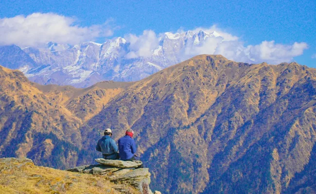
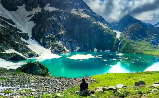
    Today is an exciting day of our trek as you will trek to the beautiful glacial lake, Ruinsara Tal. Its a 7 km trek to Ruinsara Tal and after walking for about 4 to 5 hours you will arrive at the lake and we will also camp beside this lake at night. The lovely Ruinsara Lake is surrounded by meadows and Rhododendron blooms, which amplifies its beauty. The campsite is wonderfully nestled in a location where on one side is the Ruinsara Lake and on the other side the Supin River. The views from the campsite are equally as beautiful as the lake. You will see Yamuna Kanta on the southwest side, the pass that will take you to Yamunotri, the source of the Yamuna River. On the east lies the majestic mountains, the Bandarpunch Peak, and Dhumdhar Kandi Range, and on the southeast, you can see Kala Nag and White Peak. You can spend the evening at your leisure and explore the area, and take some beautiful pictures. At night we will enjoy a hot dinner at the campsite and retire in your tents for a good night’s sleep.
    • 4,050m/13,300ft.
    • Altitude difference: 450m/1,500ft.
    • 7 km, 5-6 hours.
    • Gradual ascent.
    • Enough water source.
    • Kyarkoti is also known as the Black Peak base camp.
    • Base camp is at the foothill of Swargarohini.
    • Bandarpoonch glacier can be seen.
    • Base camp is a meadow covered by boulders.
    As you begin your journey towards Black Peak Base Camp, the Black Peak gradually begins to come into view. Today’s walk is quite a bit challenging and you will cross valleys and bouldered sections. Glorious mountain views greet you on both sides. It’s quite a steep climb to Kyarkoti and the bouldered patch adds to the difficulty. About an hour into the trek, you will arrive at a landslide-prone area. Be cautious and follow the guidance of your trek leader and guide. Crossing this landslide section, you will enter into a grassland patch, the Rupin River beautifully flows down below. You will be walking uphill and downhill for quite some time crossing hill after hill, crossing water bodies flowing directly from the glaciers and a rough bouldered patch before you arrive at Kyarkoti. The bouldered section is approximately 3 km and completely inclined. Once you arrive at Kyarkoti campsite, you will notice that Kyarkoti is a huge patch of grassland surrounded by boulders and snow-covered peaks. The campsite is situated right below the foothills of Swargarohini peaks. There’s also a campsite that runs by the campsite. As you settle on the campsite, you can get quite a good glimpse of your ultimate goal - the Black Peak. The evenings tend to be quite cold so keep warm layers in the ready.
    • Altitude: 4,500m/14,800 ft.
    • Altitude difference: 450m/1,450ft.
    • Trek: 5 km, 5 hours.
    • Moderate ascent.
    • Enough water source.
    • Moraine walk.
    • ABC is at the front of Black Peak and next to Bandarpoonch Glacier.
    After the Kyarkoti Camp or Black Peak Base Camp, there are 3 camps before the summit and ABC is the first one. From Kyarkoti we will head towards the Advanced Base Camp. The trail to Advanced Base Camp takes you through varied terrains from grasslands to a bouldered section which is followed by quite a steep climb through a landslide-prone area onto a moraine patch and finally to a glacier. It takes about 5 hours to climb to the Advanced Base Camp. As you climb up towards the Advanced Base Camp the path becomes narrower so be cautious and follow the advice and guidance of the Trek Leader at all times. Be especially wary of the landslide zone. Halfway through the trek, you will get your first sightings of the Bandarpoonch I and the frozen glacier stream flowing from it. Even from a distance, you can spot the huge crevasses. The last leg of the trek is especially difficult with big cracked rocks fallen from the mountain along with the sand and dust. Finally walking for about 5 to 6 hours depending on your pace, you arrive at the Advanced Base Camp. The campsite is surrounded by towering mountain peaks. Bandarpoonch stands tall in front of you in all its glory and the majestic views are enough to take all your tiredness away. The altitude of the Advanced Base Camp is quite high and the temperature drops very drastically in the evening and is quite windy as well so layer yourself up for protection against the cold. Sleep well as you have many adventurous days ahead.
    • Trek Leader will decide how to utilize this day.
    Since we will be gaining a lot of altitude in the upcoming days, it is necessary that we take a rest day and acclimatize well to the altitude. Acclimatizing the body to terrain, altitude, and temperature is highly crucial to avoid AMS. Today you will also be introduced to the gears that you will be using during the upcoming days and receive training on using the gears, walking skills, tying knots, using an ice axe, etc. Enjoy the evening and rest well at night. The next few days are going to be incredibly thrilling.
    • Altitude: 5,050m/16,500 ft.
    • Trek: 2 km, 3-4 hours.
    • Difficult ascent.
    • Enough water source.
    • Mixed walk of moraine and glacier.
    • Black peak is clearly visible from this camp.
    • Camp is Just next to Glacier.
    Today you will head to Camp 1. As you ascend from Advanced Base Camp to Camp 1, you will be greeted with the views of Swargarohini on the North and Bandarpoonch on the south. The terrain that you will cross today will be full of crevasses so be extra cautious. The trek distance is not as much so take your time to adapt to the terrain and make your way safely forward. Although today’s trek is short, it can be slightly draining because of the altitude gain. The trail is pretty tricky to navigate as well. Sometimes the trail is visible and then becomes narrow and even disappears at times. The trail is pretty inclined and filled with rocks and boulders making it quite challenging. The landscape changes pretty drastically. From the dry lands at the base of the mountains, you will soon arrive at the dry glacier beds. After about 2 hours of walking through rugged terrains, you will arrive at Camp 1. Settle in the campsite and take in the wonderful views around you, soon you will be submitting the Black Peak itself. You can walk around the campsite and get yourself acquainted with the terrain. The sunset from Camp 1 is especially beautiful, the colours of the setting sun paint the sky and the snow-covered peaks in vivid hues creating a mesmerizing visual treat. Once the sun sets, it increasingly becomes colder and colder and the wind also kicks up in speed. Make sure that you have enough warm layers on. You will have a delicious dinner before retiring to your tents. Tomorrow you will be heading to the Summit Camp.
    • Altitude: 5,500m/18,000 ft.
    • Altitude difference: 450m/1,500ft.
    • Trek: 3 km, 4-5 hours.
    • Moderate ascent.
    • No water source only snow.
    • Mostly Glacier Walk with open and hidden crevasses.
    • Experienced trek leader and guide is needed to show the route.
    • Dhumdhar Kandi Pass can be seen on the left side while trekking.
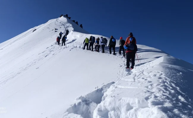
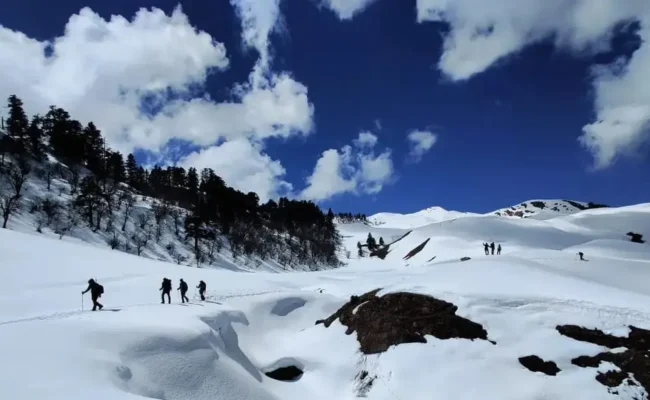
    Wake up to a beautiful morning with the sun casting a golden glow on the Black Peak and Bandarpoonch I. Take a few minutes to appreciate the magnificent play of nature. After having breakfast at Camp 1, we will be heading towards Summit Camp. Today and tomorrow are the most important days and also the most adventurous. While the distance today is short, just about 3 km but the previous days walk will give you an idea of how difficult the terrain could be. Today, you will be walking completely over snow and working together as a team as you approach the summit. The climb begins with a gradual incline and once you have made up the incline section, you arrive at a flat surface that opens up the full view of Black Peak. You can capture the majestic beauty of Kalanag in your cameras here. You can also see enormous crevasses and small snow bridges on your way. White-covered mountain ranges surround you on all sides and it just appears surreal to all the senses. The journey to the Summit Camp will be full of ups and downs, sometimes you will climb steep inclines and sometimes you will be walking on flat trails as well. There is a quick elevation gain so maintain a steady pace and do not over-exert yourself. Crossing ice bridges, navigating around crevasses, and climbing over steep sections with knee-deep snow at times, you will arrive at the summit camp. The wind catches speed by minute as the evening sets in and the temperature is going to be subzero in this campsite. You will have a delicious evening snack and a hearty dinner before you go to sleep. The most thrilling day awaits you tomorrow.
    • Altitude: 6,387m/20,950 ft.
    • Altitude difference: 890m/2,900ft.
    • Trek: 3 km, 7-8 hours (one way).
    • Technical ascent with 75 to 100 feet vertical wall.
    • Fixed rope climbing system is required.
    • Start summit push by 02:00 am.
    This is the day you have been anticipating all along your journey. Today, we will be attempting to summit the majestic Black Peak. This is going to be an in interesting experience as we will be pushing for the summit after midnight. We start towards the summit around 1’o clock. This is the big day everyone has been waiting for. After a complete check by our team, we will start towards the summit. The only light that you have at this hour is from the headlamps so be extra cautious as you move forward. Approaching the summit today is all about tackling the heavy snow covers and maintaining a steady pace as you keep gaining elevation. You will be navigating around crevasses that aren’t as easily visible which adds to the challenge of the trek. The entire trek today is inclined and completely covered with layers of snow. Follow the steps created by your Trek Leader on the snow. Around the break of dawn, as the first rays of sun hit the slopes, you will be mesmerized by the sight of such huge mountains surrounding you on all sides. The morning glow of the sun casts its golden shadow on the snow-covered peaks basking them in the golden hour glory. It is a sight that remains imprinted on your memory forever. The trek to the summit in the final leg follows a zig-zag path and soon you will arrive at the summit of the Black Peak. For the last 500 m, you will rope up with your team and climb up. This may just be the hardest climbing experience for you. Soon you will find yourself standing at the summit of the mighty Black Peak. It is a divine feeling, standing atop this mountain and watching many Himalayan peaks up-close that seem just a stone’s throw away. Sit down for a while and enjoy the grand summit views. After spending about 30 minutes at the summit, we will begin our descent to the summit camp. The descent will be much quicker than climbing up and in about 3 hrs you will arrive at the summit camp once again. Tonight we will stay at the summit camp and descend to the base camp the following. Sleep well with the sense of accomplishing the summit to Black Peak. It’s a great achievement for any adventure lover.

    • Altitude: 4,050m/13,300 ft.
    • Altitude difference: 1,000m/3,300ft
    • Trek: 10 km, 6-7 hours.
    • All descent.
    • Altitude: 3,600m/11,800ft.
    • Altitude difference: 900m/2,950ft.
    • Trek: 7 km, 4 hours.
    • Enough water source.
    Today we will be heading towards the beautiful Ruinsara Tal that you crossed on the 4th day of the trek. We will start our journey after breakfast as usual. The descent to Ruinsara Tal is a combination of incline and decline.  Walk over grassy slopes, cross over mountains and walk under waterfalls as you make your way to the serene Ruinsara Tal. Today we will camp beside the tranquil lake basking in the peacefulness of the surroundings. Ruinsara Tal campsite is a fresh change of scenery after spending so many days without vegetation in sight.
    • Altitude: 2,600m/8,500ft.
    • Altitude difference: 1000m/3.300ft.
    • Trek: 17 km, 8 hours.
    • Enough water source.
    From Ruinsara Tal the trail is mostly a descent all the way to Seema. Today you will be walking for 17 km, the longest trekking day so far. The trail from hereon is well-marked and much wider than the one you have been climbing up on and thus the navigation was much easier. Soon you will reach a wooden bridge with the Rupin River flowing under it. Be very carefully while crosisng the bridge and soon you will arrive at the location where you had your first sighting of Black Peak and Bandarpoonch. From here, the walk is much easier till Seema and once you reach the village you will again be in civilization after a couple of days. After a hearty day, we will call it a day.
    • Altitude: 2,400 m/ 8,000 ft (Dhatmeer), 1,950m/6,400ft (Sankri).
    • Seema to Dhatmeer trek: 10 km | 5 hrs
    • Dhatmeer to Sankri drive: 18 km | 1-1:30 hrs
    Start your day with a hearty breakfast. Today you will hike from Seema village to Dhatmeer and drive back to Sankri. Start walking by the Thamsa River and along pine forests. In about 5 hrs you will arrive at Dhatmeer, the point from where you started your trekking journey. From Dhatmeer, you will be driven to Sankri. You can finally take a fresh shower at the guest house. You can spend the evening at your leisure, roaming around the village.
    • 220 km drive, approx 10 hours.
    • Driving Time - 7 am - 6 pm.
    • Breakfast and lunch excluded.
    • You will be dropped at Dehradun station in a Tempo Traveller or a similar vehicle.

    Today is the day you bid adieu to the mountains. Well start for Dehradun early in the morning. Tata Sumo or other similar vehicles will be arranged for you at Sankri to drive you back to Dehradun. We have to cover a distance of 220 km and it will take about 10 hrs so the earlier we start the better. We will return through the same road that we came on the first day. Cherish the nature around with picturesque vistas stretching alongside far and wide. We will reach Dehradun by 6:00 PM so make your further bookings accordingly.

    Day 16 & 17: Buffer day.

    • Buffer day will be used if unable to summit due to of any unforeseen circumstances.
    • Opting a buffer day will be a team decision not an individual.
    • Keep a buffer day in your travel plan.
    • Buffer day is not included in the cost.
    • If buffer day is not used in the Expedition then it can be used to explore Rishikesh/Haridwar/ Mussoorie .
    • Rishikesh is known for White water Rafting capital of India, Bungee jumping, Yoga, Ayurvedic Massage, Ram Jhula, Lakshman Jhula, Parmarth aarti, Big ashrams.
    • Haridwar is known for Pilgrimage, Numerous temples, Har Ki Pauri, Ganga Aarti, Jungle safari in Rajaji National Park, Ayurvedic medicines and herbal remedies.
    • Mussoorie is known for Mall Road, Shopping, Kempty Falls, Municipal Garden, and Sir George Everest house.
    • Distance, Altitude, and Trekking hours are approximate and rounded off
    • Keep the original and copy of ID proof handy
    • Come one day early if planning to come by plane

Package Features List

Include Features

Exclude Features

Frequently Asked & Question

The Black Peak excursion is moderately challenging, demanding technical climbing skills, high-altitude experience, and proper acclimatization. It requires careful navigation through steep terrain and often unpredictable weather conditions, making it suitable for experienced mountaineers.   

Black Peak, which is in the Garhwal Himalayas, is often known as Kalanag, which means “Black Cobra.” It is named Kalanag because the top part of the peak resembles a black cobra.   

The altitude of Black Peak is approximately 6,387 meters (20,955 feet) above sea level. This altitude makes it one of the challenging high-altitude climbs, requiring adequate preparation and acclimatization to mitigate the risks associated with high elevations.  

The risks involved in the Black Peak expedition are notably high due to the challenging terrain, which includes the potential for avalanches and extreme weather conditions. Also, several altitude-related illnesses include acute mountain sickness, high-altitude pulmonary edema, and high-altitude cerebral edema.

The best time for the Black Peak expedition is during the pre-monsoon season (May to June) and the post-monsoon season (September to October). The weather is more steady during these times, with clearer skies and milder temperatures. This makes climbing easier and ensures better visibility for the expedition’s breathtaking views.   


₹ 8,5000 Per Person

  • Mony Back Guarentee.
  • Your Safety is Our Top Priority.

Customize

Travel Package!

60+ Guide Await to Help You