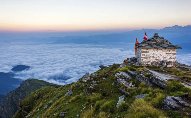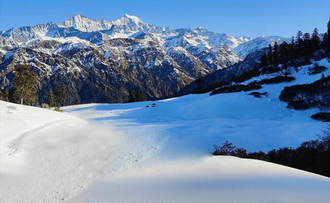
Did you know Asia’s largest alpine meadow is located in Uttarakhand’s Garhwal Himalayas? You heard it right, we are talking about Ali Bedni Bugyal, located in Chamoli district at an altitude range of 11,004 ft-12,550 ft. These twin meadows feature vast stretches of grass fields carpeted with colourful wildflowers that seem to meet the sky. Adding to this, the full-face (6,000-7,000 ft) view of Mt. Trishul and Nanda Ghunti will leave you speechless. The views here are so mesmerising that Bill Aitken, a famous travel writer, in his book ‘Touching upon the Himalayas‘ compared Bedni Bugyal with the Elysian Fields (eternal paradise of Greek mythology).
The Ali Bedni Bugyal Trek covers a total distance of 31 kilometers (19 miles) which takes about 4-5 days to complete. In this duration the trek route reaches the maximum height of 12,550 feet (3,825 meters) above sea level. The trek begins from Lohajung, a small mountain village that serves as the perfect base camp, offering the stillness and charm of mountain life. Its beauty will leave you wondering—if the base camp is this stunning, how amazing must Ali Bedni Bugyal be! From here, you will pass through dense oak and rhododendron forests, gradually ascending to open meadows. The forest trail winds through diverse terrains, presenting you with an incredible visual feast.
Uttarakhand
Lohajung
6 Days
Easy-Moderate
31 km
12,550 ft
Drive Distance: 250 km
Altitude: 7,800 ft
Today’s Difficulty: Easy
Highlights: A scenic drive via Devprayag, Rudraprayag and Karanprayag.
Lohajung is the basecamp for Ali Bedni Bugyal Trek. It is a small Village in Chamoli district, accessible from Dehradun and Rishikesh. Locals believe Goddess Parvati fought with the demon Lohasur in this place, giving it the name that translates to ‘war (Jung) with Loha.’
When travelling from Rishikesh, the yoga capital of Uttarakhand, you will encounter the three Prayags on your route. First, you will reach Devprayag, where the Alaknanda River merges with the Bhagirathi to form River Ganga. Further, the route will take you to Srinagar and Rudraprayag, where Alaknanda combines with Mandakini. Next, we will arrive at Karnaprayag, which marks the place where Alaknanda meets Pindarganga. From here, we will reach Tharali and, passing through Deval and Mundoli, arrive at Lohajung.
You can take a shared taxi from Dehradun to Deval via Rishikesh. From here, you can hire another cab to Lohajung. UTC bus services for Lohajung are also available from Rishikesh and Dehradun.
Remember to carry cash, as ATM services are not available here. Try to start your journey from Rishikesh early in the morning in order to reach Lohajung by evening. Here, you can explore the village and rest overnight to begin your trek full of energy on the next day.
Trek Distance and Time: 6 km; 4-5 hours
Altitude: 8,000 ft
We will start our trek from Lohajung to Didna Village early in the morning. The route passes through Kuling, which is 4 km from Lohajung. The hiking trail begins with a gentle descent for the first few kilometres. After continuing walking for a few minutes, you come across a small river. From here, the trail continues with a gradual ascent on a rugged path with small boulders and moraine.
A further hike of 2 km from Kuling will take you to Didna Village. Here, you will pass through small stepped fields and small clearings where you can rest and relax. The dense vegetation of Didna, which includes Rhododendrons and Apple trees and the simplicity of its village life, will wash away all your tiredness. Here, you will find many homestays that offer homemade food and tents to help you rest and relax for the night.
Trek Distance and Time: 12 km; 6-7 hours
Altitude Gain: 12,000 ft
On the third day of our trek, we will cover a distance of around 12 km from Didna to reach our first destination, Ali Bugyal. This section of the trail is easy to moderate, with a gradual uphill climb along dense coniferous forests and small clearings.
After an easy hike of 2.5 km, you will reach Tolpani, a small settlement where shepherds tend to their sheep. Along the trail, herds graze on lush green clearings, bringing joy to your heart and lifting your spirit with each step. Here, you will also come across the Chaukhamba Peak viewpoint.
As you hike uphill, the scent of oak and pine fills the air, while sun rays playfully weave through the dense canopy, creating a mesmerising experience. The trail levels out as you approach Ali Bugyal, and the forests begin to thin, revealing stunning views of the surrounding peaks.
At Ali Bugyal, you will find a vast expanse of velvet grass carpeted across the ridge. The greenery tempts you to feel the grass on your toes to help you relax your feet after an exhausting journey. After walking for an hour, you can reach the top of Ali Bugyal. Here, you can catch the top view of the colourful rooftops of the huts of Didna surrounded by a thick blanket of clouds. We will conclude our day here, and camp at Abin Kharak, a depression in Ali Bugyal.
Descend and Time: 3 km; 2 hours
Altitude Gain: 12,550 ft
Highlights: Meadow Walk, View of Mount Mrigthuni and Trishul, Bedni Kund, and Bedni Bugyal
If you want to see Ali Bugyal at its best, wake up early to catch the beautiful sunrise, something you don’t want to miss. Today, we will explore the second alpine meadow, Bedni Bugyal. This trail section is short in distance but can be a test of fitness due to the terrain’s slightly steep and rugged nature.
We will ascend to the top of the ridge at Ali Bugyal from Abin Kharak, our campsite. We can easily cover the distance from Ali Bugyal to Bedni Bugyal (approx. 2.5 to 3 km). There is no habitation on this trail, so carry enough food and water for this day.
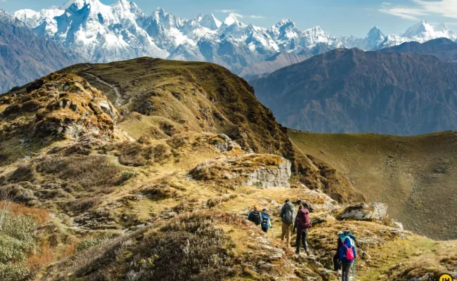
As you approach the Bedni Bugyal, you will spot a signboard indicating its location. Upon reaching, the green meadow dotted with yellow, pink, and red wildflowers and the majestic peaks of Trishul and Nanda Ghunti in full view, will leave you in awe of nature’s beauty. A slight descent at the Bugyal will take you to Bedni Kund and a small ancient temple near it. These are important religious sites for the Nanda Devi Raj Jat Yatra, performed every 12 years by the locals.
We will trek back to our campsite at Ali Bugyal to spend the night. The descent is easier and should take about half an hour to an hour to reach the camp, depending on your pace.
Descend and Time: 10 km; 4-5 hours
Altitude Gain: 7,874 ft
Highlights: Forest Trail, Ranka Dhar, Wan Village and Latu Devta Temple
Today, we will hike back to our base camp, Lohajung via Wan Village (approx. 10 km) and visit many attractions along the way. The trail to Wan Village goes through dense coniferous forests of oak, pine, walnuts, and rhododendrons, among others. Do not forget to take short breaks on the trail to catch glimpses of the Trishul mountains from different viewpoints.
The descent is easy and will take you to the Neel Ganga River, which twists and turns at full speed through the mountains. This is a great place to rest and relax before you continue your hike across the bridge over the stream. From here, you will ascend to Ranaka Dhar through the lush forest trail filled with fallen leaves and wild grass. At Ranaka Dhar, you can get a bird-eye view of the entire valley of Wan and Lohajung.
Further, you will continue your descent to Wan Village, where you will notice tall and old Cypress Trees or Christmas Trees. Here, you can pay a visit to the famous Latu Devta Temple, another religious site for the Nanda Devi Raj Jat Yatra.
At Wan, you will find many local taxis to take you back to Lohajung. You can also spend a night at Wan to explore the village and continue the trek to the base camp the next day.
Drive Distance and Time: 250 km; 10-12 hours
This marks the end of our Ali Bedni Bugyal Trek. After enjoying a hearty breakfast in Lohajung, we will drive back to Rishikesh early in the morning. The total distance between Rishikesh and Lohajung is around 249 km, which will take about 10-11 hrs to reach our final destination.
Do not forget to relish the beautiful views of the three Prayags, valleys and peaks on your way back.
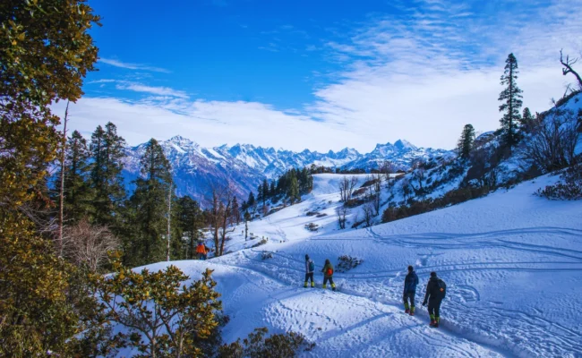
For trekkers, the winter season, especially December, January and February, is a perfect choice, which will be made even better by good snowfall in Ali Bedni Bugyal. After snowfall in the winter season, the meadows, Himalayan peaks including Trishul and Nanda Ghunti and the surrounding area turn into beautiful natural snow beauty. When passing through the forests in winter, the first rays of the morning rise and reach close touching the icicles, bringing a kind of freshness and vitality in the heart. Apart from trekking, the snowy areas make this place suitable for skiing trips and other snow-related activities.
While altitude sickness might not be a real concern during the Ali Bedni Bugyal Trek, you must be very careful because safety is the first priority. This destination lies at an altitude of approximately 12,550 feet above sea level. While going above 8,000 feet increases the chances of altitude sickness, if you properly acclimatize and follow all the precautions, you will not be affected by AMS or any other sickness. Overall, altitude sickness is not common on the Ali Bedni Bugyal Trek, but you are advised to inform your trek leader if you experience any symptoms.
Jolly Grant Airport, also known as Dehradun Airport, is the nearest airport to Ali Bedni Bugyal. It is located approximately 25 kilometers from Dehradun and 15 kilometers from Rishikesh.
60+ Guide Await to Help You
Explore similar tours and treks that match your travel interests.
Don’t hesitate Call
+91 - 8650929590
outdoorhikerstravel@gmail.com
+91-7505809080
© 2026 Outdoor Hikers – All Rights Reserved Powered by: Abliq Technologies