
WhatsApp
+918650929590


Pick Up & Drive: From Manali 16 km drive, 1-2 hours
Trekking Distance & Duration: 3 km, 2 hours
Altitude Gain: From Manali (2,100 m / 6,400 ft) to Jobra(3,000 m / 9,800 ft): 3,400 ft/ 1,036 m ↗ | Jobra to Chika (3,100 m / 10,100 ft): 300 ft/ 91 m ↗
Difficulty Grade of The Day: Easy | Mostly flat with mild uphill
Highlight/s of the Day: Scenic drive through Manali | A short trek amidst the forest of pine, deodar, maple etc.
To begin our trek, you must first reach Manali, a famous city in the Kullu district in Land of Snow, Himachal Pradesh. Manali is known for its lush forests, snow-capped mountain peaks and ancient trade routes that cross through various passes like Rohtang and Baralacha.
After reaching Jobra, we will start our trek marking the official beginning of our trek. The trail will be filled with tiny rocks, small streams, and tall trees of Deodar, maple, pine, etc. Once we hit the trail, it won’t take long before you come across a small shop offering eatables and other essential items. By just walking a few more metres you will be greeted by the sight of the Rani Nallah, a charming stream winding its way through a lush meadow. You will see many cattle like sheep, calves, cows grazing in these verdant meadows.
Keep walking along the left side of the stream; it will be filled with boulders and rock, but it will not be too difficult to walk on. Whereas, on the right side you will see small trees of rhododendrons and birch. While there are several routes, this is the best way to climb over a hill and descend into the vast, open expanse of meadows where Chika lies.
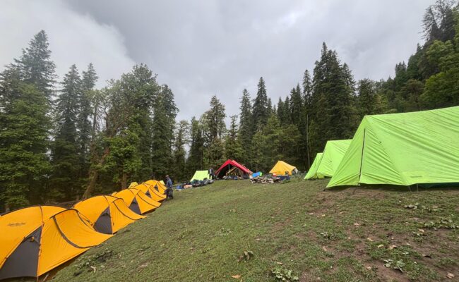
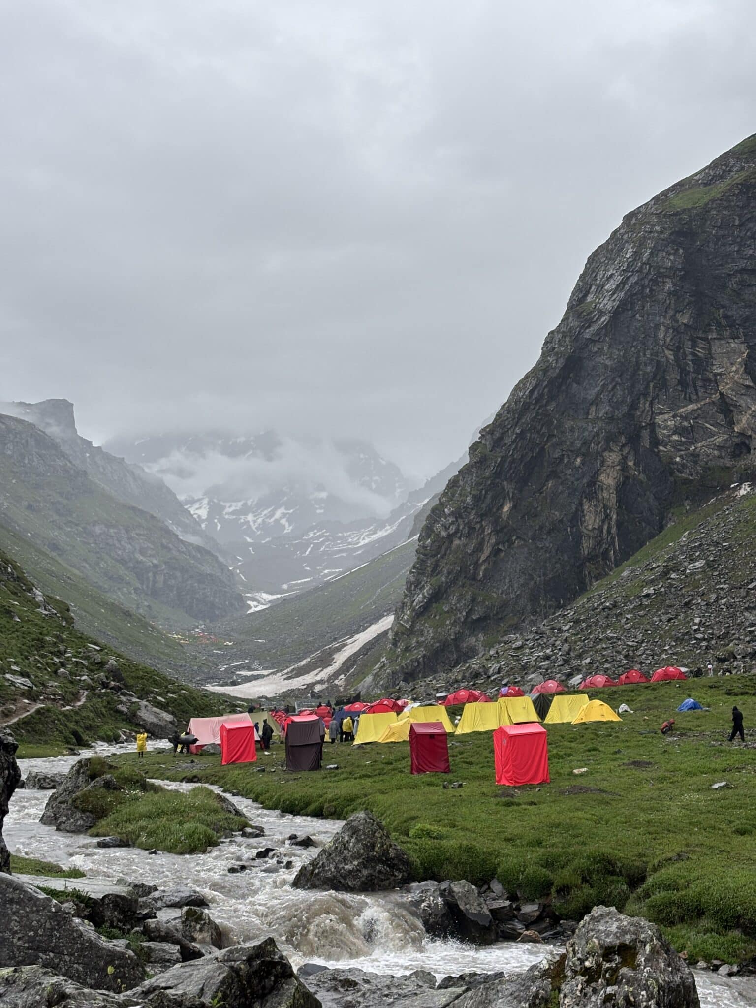
Chika is the most favourable campsite for night stay, providing a constant water source, the Rani Nallah stream encircled by the Pir Panjal mountain range.
A little far on the right of Chika campsite, you will see many waterfalls marking another campsite, Jwara. After a light snack and dinner, we will rest for the day.
Trekking Distance & Duration: 9 km, 6-7 hours
Altitude Gain: Chika to Balu ka Ghera (3,800 m/ 12,400 ft): 2,300 ft/ 701m ↗
Difficulty Grade of the Day: First half – Moderate/Steep Ascent
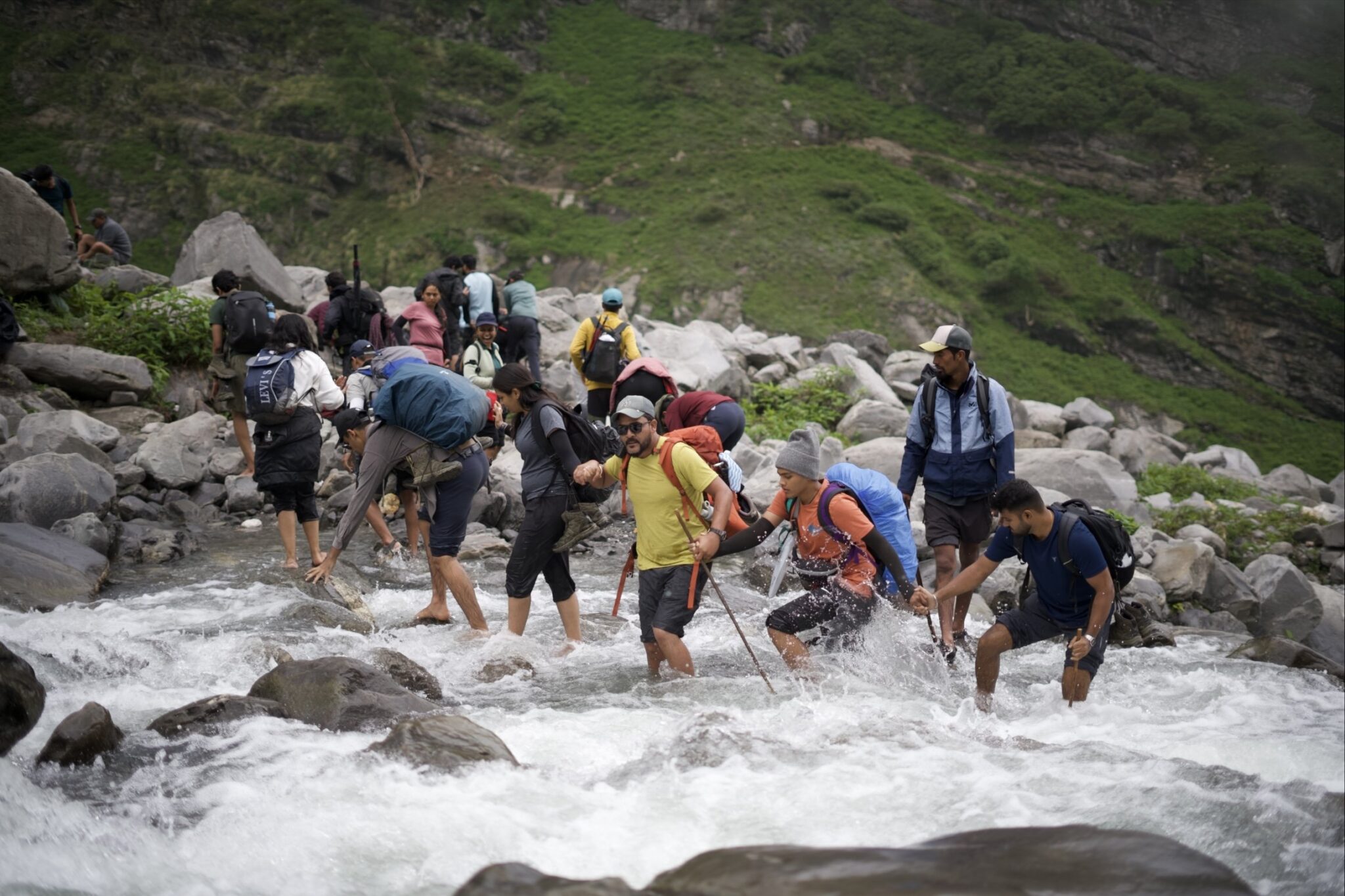
Highlight/s of The Day: Rani Nallah river crossing
Today, we will start our trek early by having breakfast at 8 am and then start the hike. Our campsite for today, Balu ka Ghera literally translates into “Land of Sand” or “Bed of Sand.” The site is formed over the years when the river carries the debris after a landslide and deposits it here.
The trail today will be of rough gradient filled with big boulders that are spaced far from each other, making the jump between them difficult. Instead, we will hike cautiously while indulging in the nature as our path is also steep today.
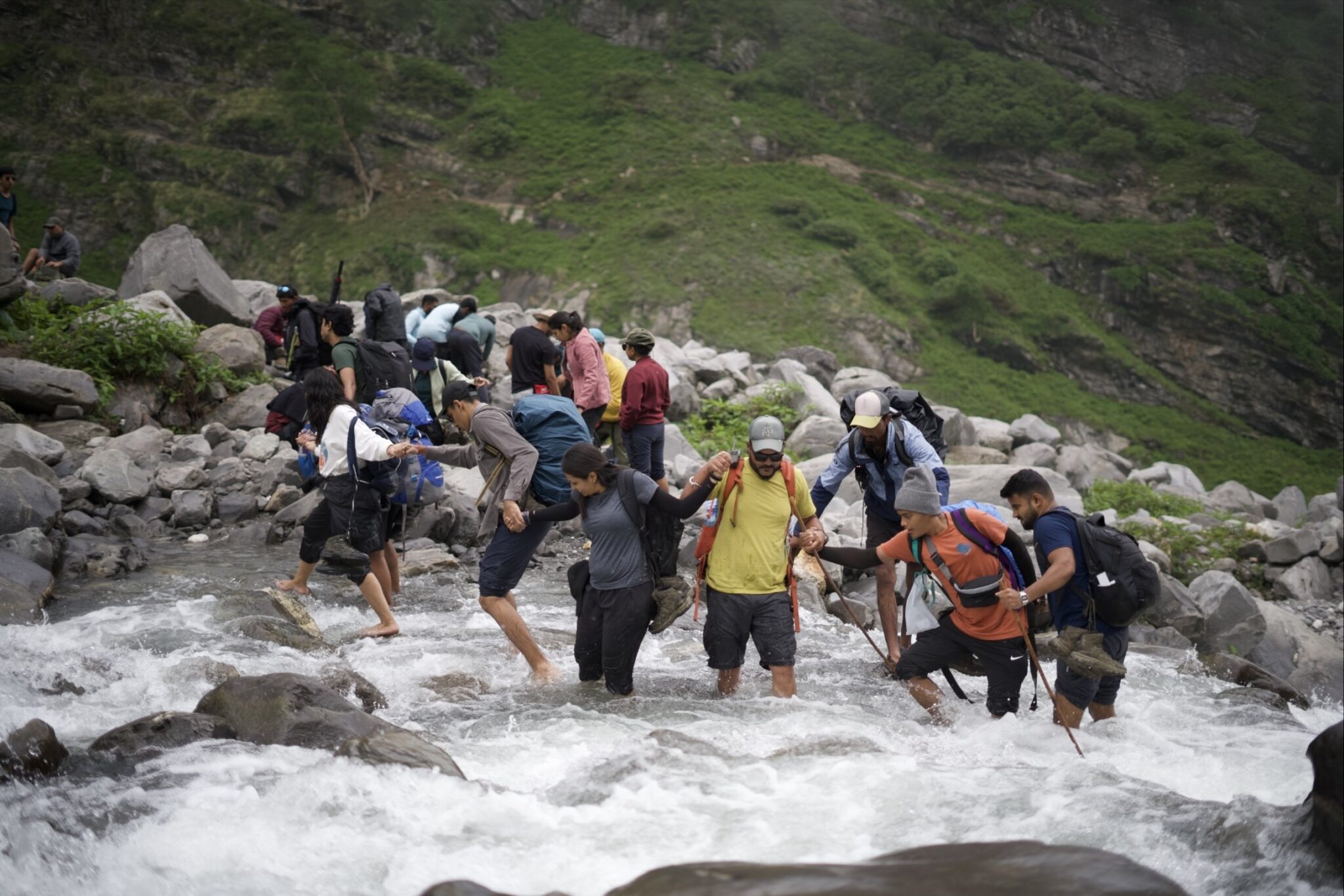
After walking for a while, be prepared to feel the cold water of the gushing stream as you have to cross the stream of Rani Nallah stream. Our trek leader will first cross the stream to check for any danger and then you all will follow.
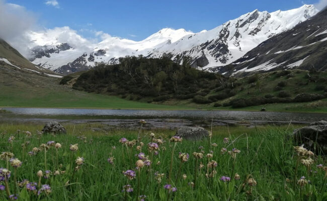
Crossing the chilling stream will refresh you and fill you up with the new enthusiasm. For some time the rough terrain will continue and after a while the flat surface of Jwara will begin. On your way you will find many colourful flowers on the trail like marigold, blue poppies, and a bunch of other cluster of flowers in red, pink, orange, etc. amidst tall snow-covered Himalayan peaks creating a postcard perfect image.
After hiking for another 3-4 km, the terrain gradient will slowly start to change into a land covered in sand and other debris, which the river carried over here and created this beautiful site, now our perfect campsite of Balu ka Ghera.
Trekking Distance & Duration: 9 km, 8-9 hours
Altitude Gain: Balu ka Ghera to Hampta Pass (14,100 ft/ 4,300 m): 1,700 ft ↗ Altitude Loss: Hampta Pass to to Shea Goru (12,900 ft/ 3,900 m): 1,200 ft ↙
Difficulty Grade of the Day: Moderate to Difficult | The ascent of Hampta Pass is steep and the descent from there is equally challenging
Highlight/s of the Day: Rocky Terrain | Crossing the Hampta Pass | Changing terrains from vibrant meadows of Kullu to rocky & cold desert of Lahual, Spiti Valley.
Today’s trek is an exciting mix of challenges and rewards. The trek can be divided into two parts, first, you’ll tackle the hike and the mountain climb to Hampta Pass, a moderate yet steady ascent. Then comes the steep descent to Shea Goru, which requires careful footing, especially if snow’s there.
Your goal? Reach the pass by lunchtime, take a well-deserved break, soak in the views, and then start your way down to Shea Goru campsite.
We will start our day early, given our goal for today. After having a delicious breakfast, we will walk along the river. If you are trekking in summer, then you’ll be surprised by the delightful flowers varying in colours beside the riverbank, resembling the “Valley of Flowers”. For an hour you will continue on this gentle and beautiful trail.
Note: Remember to fill your water bottles here and carry at least two bottles of 1 litre each with you as the next water source in quite far from here.
But soon you will be above it and the terrain will change into a more tricky and rocky grade. The trail will not be marked well from here, so hike accordingly, and be with your group or you might get lost.
After passing a rocky section, the climb for your first incline will begin. It will take around 30 minutes to cross and then you’ll reach a plateau like space – a perfect spot to catch your breath. If you are trekking in early season, then you will witness this entire stretch blanketed in snow, giving out Narania vibes.
After the short break, the next climb awaits you. This section has two steep sections which lead you to a ridge, which will take you through Hampta Pass. The surrounding beauty and changing landscape in Hampta Valley will leave you in awe and you won’t realise when you reach the Hampta Pass.
The last stretch to Hampta Pass is a steep incline, filled with big boulders adding more challenges to your hike. But after reaching the top at an altitude of 14,100 ft your every step will feel worth the effort. Savour the moment and try to identify various peaks like Hanmuan Tibba (19,600 ft), Indrasan Peak (20,401 ft), and a few unnamed but uniquely shaped peaks like Duel Horned Peak.
Now, the tricky part—the descent. Depending on the snow conditions, you might even be able to slide down sections! Follow a zig-zag path, keeping to the right of the mountain. The first steep downhill stretch takes about 30 minutes, bringing you just below the pass. From here, you’ll either make your way down a snowy slope or follow a winding trail until you reach the valley floor in about 1.5 hours.
Now begins the tricky part of Hampta Pass – the descent into the Lahaul Valley in Spiti. Depending on snow conditions, you might just roll down the section (do not attempt this, trust us it will be painful). While descending, turn around and spot Deo Tibba (19,690 ft), just behind the Indrasan peak
Follow a zig-zag path for better footing while keeping right of the mountain. This first stretch will take about 30 minutes, covering a small section just bringing you below the pass. Descend down for another 1.5 hours following the same zig-zag method until you reach the valley.
If you’re trekking after the snow is melted, then you’ll find the path filled with big blocks of stones, boulders all the way till the final descend.
The valley will showcase a completely different terrain, showcasing the uniqueness of the Himalayan mountain ranges and terrains. The final leg of today’s hike is walking along the Chandra river to reach Shea Goru Campsite.
Today’s campsite is way more different than our previous ones with a changed rocky terrain, between the Spiti ranges, also making it our coldest campsite. After reaching the campsite of Shea Gora, take the well-deserved rest and relax under the starry night.
Trekking Distance & Duration: 7 km, 5 hours
Drive: 50 km, 3-4 hours (one way)
Altitude Loss: Shea Goru to Chatru (3,350 m/ 11,900 ft): 1,000 ft/ 304 m↙ Altitude Gain: Chatru to Chandratal Lake (4,300 m/ 14,100 ft): 2,200 ft/ 670.5 m↗
Difficulty Grade of The Day: Easy
Highlights of the Day: Witnessing the infamous Chandra Taal, a high-altitude lake located in the Spiti Valley
Today marks another important day in our trek as we will descend down and drive to the Chandra Tal. As we have to cover the long distance of a drive twice a day, it is advised to start your day early in the morning so that you reach Chandratal in the morning itself or noon.
The downward hike today will be of easy grade of 7 kms which can easily be covered in 4-5 hours. Though due to different weather conditions, you may find some patches muddy and sloshy, so be careful while descending.
The drive will be filled with a bumpy road and coiling roads with an altitude gain. Be prepared by hydrating yourself, and if in case of AMS (Acute Mountain Sickness) take the necessary medicine like avomine.
After the drive, lay your eyes on the majestic yet graceful destinatoin- Chandra Taal. The crescent moon shaped lake lies in the watershed of the Chandra river in Lahaul Valley. Even in the rugged terrain, the lake maintains the flora and fauna nearby. You may spot fauna like blue sheep, Himalayan Ibex, Chukor, red fox, etc, and in the summer season you might spot a migratory species like Ruddy Shelduck.
After spending soaking in the beauty of the lake, we will head back to Chatru and rest for the night.
Drive: 83 km, 2-3 hours
Altitude Loss: 5500 ft/ 1676m↙
Highlight/s of the Day: A picturesque drive from Chatru to Manali via Rohtang Pass
Today marks the final drive of our trek, and our journey back to Manali will pass through Rohtang Pass. We will drop you off at Manali Mall Road, leaving you with amazing memories and thrilling stories to share. The rest of the day is yours to explore the charming town of Manali, head back to your hometown, or continue your journey to the next destination in the Indian Himalayas.

Explore similar tours and treks that match your travel interests.