
WhatsApp
+918650929590


| Altitude | 6,400 ft |
|---|
The trek begins at the Sankri Village located in the Govind Pashu National Park region. A comfortable drive from Dehradun passing through Mussoorie, Kempty Falls, and villages like Purola, and Mori, will get you to Sankri. You will have the pristine sacred waters of the Yamuna river and Tons River, for company through the journey.
This village serves as the base camp for many other popular treks like Kedarkantha, Har ki Dun. This is the last village where you can buy or rent trekking gear, in case you need some last minute fixes. You will spend the night here at a guesthouse or a camp, and gear up for the trek ahead.
| Trek Distance & Time | 12 km/ 7-8 hours |
|---|---|
| Altitude | 8,500 ft |
After a delicious breakfast, a 12km jeep ride will take you from Sankri to Taluka from where you will begin trekking. This is a landslide-prone route and is usually closed during monsoon season. The trek begins with a gentle 4km climb through Deodar and Rhododendron forests. From Taluka, the trail descends to the river valley of Supin on the right and forests to your left. You will spot two bridges on your way from where you can fill up your water bottles. So, make sure to hydrate well to avoid being hit by AMS.
Continuing downhill, trekkers will encounter a tributary of the Supin River, crossed via a wooden bridge. The river then drains the upper reaches of Swargarohini and merges with Rupin River and forms Tons River. After a brief climb, the path splits, opt for the straight route, avoiding the upward trail. The terrain becomes challenging as it is prone to landslides, and hence requires careful navigation. The trail then brings you to forested areas with a few ascents.
You will then arrive at the quaint Gangad Village which is inhabited by the Bhotiya Tribe, who are mostly shepherds. This village is known for its unique architecture and gives you a chance to experience the authentic Garhwali culture. You will cross a bridge Chelud Gad to reach the other side of the river. The route from here will take you to Seema village, which is an uphill trek. This is where you will camp for the night. In case there is no camping spot available here, you could camp at Chelud Gad only instead.
| Altitude | 10,124 ft |
|---|
On Day 3 you will take the trail going down with River Supin on your left. From here the trail brings you to the entry point of Ruinsara Valley, and will pass by a series of streams and boulders as you enter the Ruinsara Forest. You will see Osla village behind you. After 30 minutes of walking later, you will find yourself at the Devsu Bugyal, a meadow which is 2 km long. Towards your left you will see the stunning Har Ki Dun Valley, and you will also get the magnificent views of the majestic Kala Nag Peak (Black Peak).
Take a midday break at the Devsu Bugyal admiring the beauty around, before you continue further.
From here the path descends into the slippery riverbed and then climbs up. The final 2 km to Rain Basera involves traversing a vertical slope with loose stones, so tread cautiously while maintaining your balance. The campsite is pitched at Rainbasera, the name rightfully translates to ‘resting place of the night’. You can spot Himalayan griffons and Himalayan marmots on this stretch. Do not leave any food unattended due to the risk of Himalayan black bears roaming at night. You don’t want to get into a bear fight, do you?
| Altitude | 11,700 ft |
|---|
The day starts with a steady descent to the Ruinsara river to begin with. After crossing a wooden bridge, the trail follows the river through the valley with moderately challenging terrain for about an hour. From here you will be treated to spectacular views of the Ruinsara Valley.
After navigating difficult sections on the trail for another 1.5 hours you will pass a waterfall and ascend to meadows covered with glacial snow. The path continues through a large meadow bordered by birch forests and requires a small river. Make a pit stop here to rest your muscles, before you take on the final leg of the trek for the day.
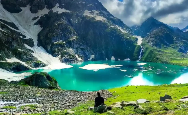
Trekking for 45 minutes through birch forests along the left side of the river will bring you to Ruinsara Tal. After exiting the forest and traversing a boulder zone you will spot the Ruinsara Lake surrounded by meadows and rhododendrons which is suitable for camping. You will also pass by a shepherd’s hut, that is a temporary shelter during summer grazing months. The hut with a simple stone structure gives insight into the transhumance practice, seasonal movement of livestock.
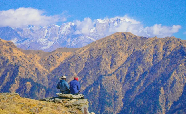
This campsite is one of the most beautiful sites on this trek. The lake is at the foot of Mt. Kala Nag (Black Peak). You will also be amazed by the views of Yamuna Kanta on the southwest, the pass that will take you to Yamunotri, Bandarpunch on the east.
| Altitude | 13,150 ft |
|---|
This day has the shortest trekking distance. The trek starts with a descent to the Supin River. After crossing the river with ice cold water, through a bridge, you will descend to a small meadow and continue the trek along the river. A further walk for about an hour will bring you to Odari.
Odari means a naturally made rock cave and as per the local legends, they believe that Bali spent a night here. This campsite offers some stunning views of Swargarohini peaks 2 and 3. If luck is on your side, you might spot a Himalayan Bear.
You will reach the campsite by afternoon, and will have the rest of the day to relax your body and mind, to prepare for the crucial and adventurous trek days ahead.
| Altitude | 15,100 ft |
|---|
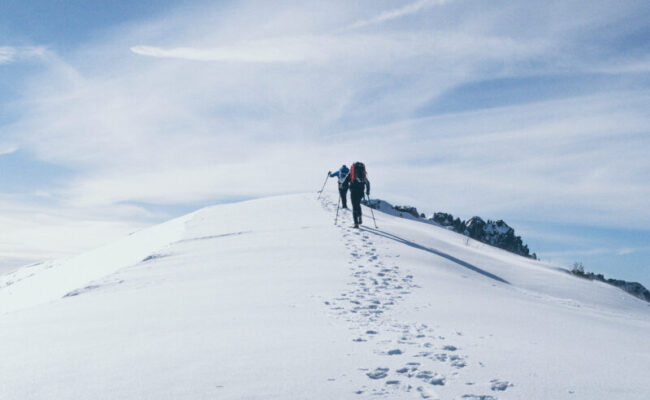
Today’s trek begins with a light distance but challenging terrain, where you will be crossing landslide prone zones. We start early to cross the Ruinsara River tributary safely and to avoid rising water levels in the later part of the day. There is no bridge here, so you will have to make your way hopping on the stones (similar to Takeshi’s Castle! Does it ring any bells?). After the crossing, the trail ascends towards snow moraines, and here you will get clear views of the Swargarohini Peak.
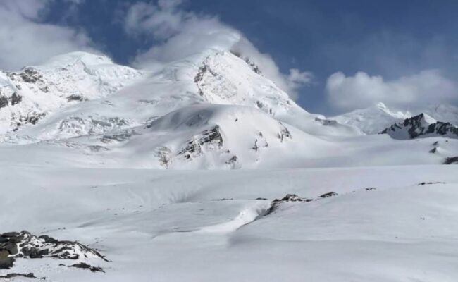
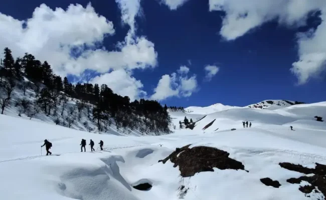
After 1–2 hours of trekking, you will find yourself on the top of a ridge. The views of the Kyarkoti Valley will now open up to your left, and Swagarohini standing behind you as you continue your trail ahead. A gradual ascent over slippery snow will get you to Bali Base Camp. You will spot an ice field with small glacial ponds.
You will observe a series of five snow ridges that need to be traversed. After another couple of hours you will reach the top of the fifth ridge. Bali Pass Col camp will be towards your left.
It is advised to carry microspikes to help you navigate slippery terrain.Carry atleast 2 litres of water as there are no water points on this section of the trek.
| Altitude | 16,200 ft |
|---|
This is hands down the most exciting (and tiring) day of this 8 day trek, where you will finally be summiting Bali Pass. The trek starts early in the morning, preferably at 6 am given the long trekking distance. The climb to Bali Pass is steep, and takes 2-3 hours to reach from the Base Camp. As there tends to be a lot of snow, it is recommended to use an ice axe to ensure safe footing. As you reach the top, you can see the beautiful Yamunotri Valley. The pass is narrow and requires careful climbing. But, once you reach there, you will be rewarded with the majestic views of Bandarpunch, Kalanag, Garhwal ranges, and also the route that leads to Saptarishikund.
After soaking in the views, you will descend along a vertical path filled with scree and stones. A snow ridge on the Yamunotri side will help you get down the pass. Fixed ropes need to be placed here. There are several routes here to descend, your trek leader will choose the best suited one for you.
If you thought the difficult part ends here, my friend you are wrong. Well, it begins here! You will see the Dhamni forest ridge. There are no marked trails, with the width of some being less than 6 inches, and so you need to trek through huge patches of snow and big boulders. This stretch is like a zigzag maze, and needs very cautious trekking. It will take around 2 hours to safely cross this. Given the complexity of the terrain, it is advised to use equipments like ice axe and pulley throughout this trail. We at Himalayan Dream Treks, provide high quality helmets and trekking equipment to ensure your safety.
After a tiring journey, you will reach Upper Dhamni and after a short rest, you will continue your trek to the Lower Dhamni camp. You will lose altitude as well, as you come down from 16,000 to 10,000 feet.
The paths on this day are confusing, hence it is advised for the group to stick together. Getting lost in the mountains is a situation you wouldn’t even want to imagine!
This is the last day of your trek and is relatively easy. A 30 minutes of ascent on a well established trail will get you to the old Yamunotri Trail. With a 4 km trek from here, you will reach the Yamunotri Temple. At the temple, you can take a dip in the Sulphur hot water springs, and seek blessings of the Goddess. From there you will descend to Janaki Chatti. If you don’t wish to go to the temple, take the trail that connects the new Yamunotri trail with the Janaki Chatti.
From there, a drive will get you back to Dehradun.

Explore similar tours and treks that match your travel interests.